

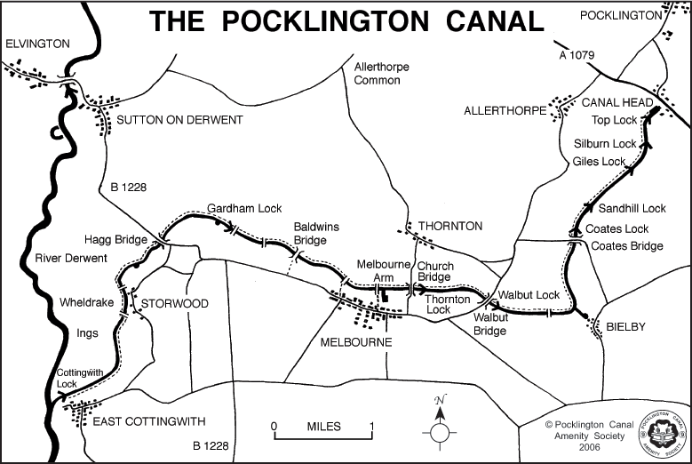
These maps give the names of all the locks and bridges on the Pocklington Canal. They can be downloaded for viewing and printing. As shown in the second map there is a towpath along the canal. This changes side at Swingbridge No.1 at Storwood.
Access to the towpath on foot is possible at Canal Head, Coates Bridge, Walbut Bridge, Bielby (via Bielby, Arm), Church Bridge, Melbourne (via Melbourne Arm), Hagg Bridge and East Cottingwith (via Canal Lane).
Navigation was extended by two miles from Melbourne to Bielby in 2018, bringing two more locks into use. The canal shown in red is not currently navigable.


PCAS has teamed up with York illustrator, Jonty Clark to offer high quality giclée prints of his beautiful canal map for sale. Originally commissioned by the Canal & River Trust as part of a Lottery-funded project, the map can be seen at various points along the canal.
A4 print in black frame - £75
A4 unframed - £50
A3 print in black frame - £95
A3 unframed - £65
Maps come signed by the artist and a 10% contribution from each sale goes to PCAS.
Bespoke versions are also available, offering individuals or businesses in the area the opportunity to highlight their location with a logo/icon and location marker. All ideas can be discussed and will be priced individually.
If you are interested in purchasing the artwork please contact Jonty directly on 07752 154807 or jonty.clark1@gmail.com